New “Destructive” Severe Thunderstorm Warning category to trigger Wireless Emergency Alerts on mobile phones

Severe thunderstorms can be life-threatening, but not all severe storms are the same. Hazardous conditions range from tornadoes, large hail storms, and widespread straight-line winds called derechoes, to cloud-to-ground lightning and flash flooding. Starting July 28, the National Weather Service will better convey the severity and potential impacts from thunderstorm winds and hail by adding a “damage threat” tag to Severe Thunderstorm Warnings, similar to our Tornado and Flash Flood Warnings.
“Destructive” and “Considerable” Damage Threat Categories
We developed three categories of damage threat for Severe Thunderstorm Warnings to distinguish between high-impact and low-impact events. The categories, in order of highest to lowest damage threat, are destructive, considerable, and base. These tags and additional messaging are designed to promote immediate action, based on the threats.
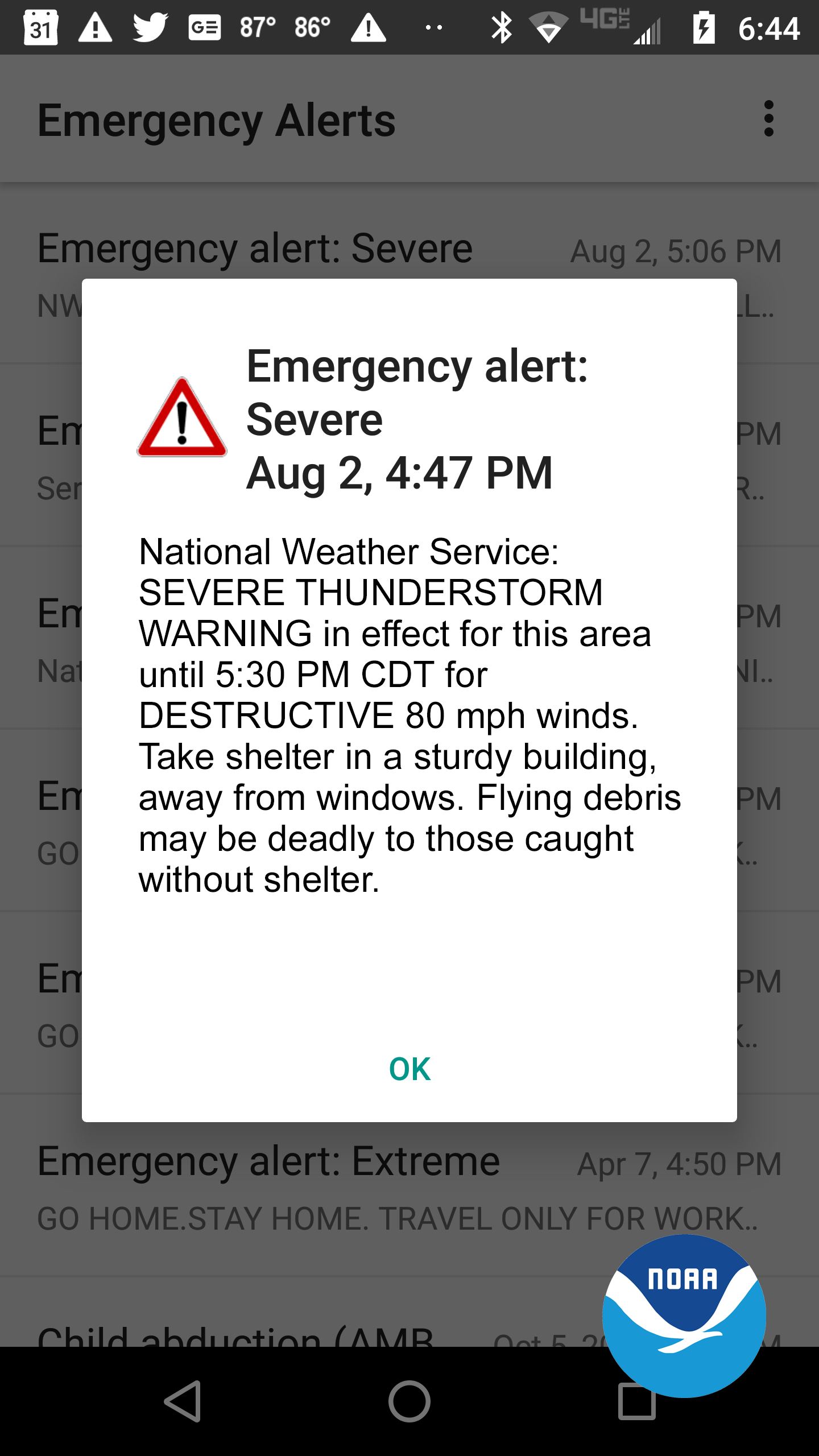
- The criteria for a destructive damage threat is at least 2.75 inch diameter (baseball-sized) hail and/or 80 mph thunderstorm winds. Warnings with this tag will automatically activate a Wireless Emergency Alert (WEA) on smartphones within the warned area.
- The criteria for a considerable damage threat is at least 1.75 inch diameter (golf ball-sized) hail and/or 70 mph thunderstorm winds. This will not activate a WEA.
- The criteria for a baseline or “base” severe thunderstorm warning remains unchanged, 1.00 inch (quarter-sized) hail and/or 58 mph thunderstorm winds. This will not activate a WEA. When no damage threat tag is present, damage is expected to be at the base level.
On average, only 10 percent of all severe thunderstorms reach the destructive category each year, nationwide. Most of these storms are damaging wind events such as derechoes and some of the larger, more intense thunderstorms, called “Supercell” storms that can typically produce very large hail in their path. The new destructive thunderstorm category conveys to the public urgent action is needed, a life-threatening event is occurring and may cause substantial damage to property. Storms categorized as destructive will trigger a WEA to your cell phone.
All National Weather Service Severe Thunderstorm Warnings will continue to be issued and distributed via weather.gov, NOAA Weather Radio, Emergency Alert System and through dissemination systems to our emergency managers and partners. The addition of damage threat tags are part of the broader Hazard Simplification Project to improve communication of watches and warnings to the public.
Thirteen of the 22 costliest weather disasters in 2020 were severe thunderstorms. The new “destructive” tag would have activated a Wireless Emergency Alert for many of these impactful events, including the costliest thunderstorm in U.S. history, the $11 billion derecho that affected Iowa in August 2020.
Learn how to stay safe in a severe thunderstorm. Knowing what to do before, during, and after severe weather can increase your chances of survival.
The NOAA Storm Prediction Center provides forecasts of severe weather up to seven days in advance, and severe thunderstorm and tornado watches several hours before storms form.
Explore our Severe Weather 101 webpage.